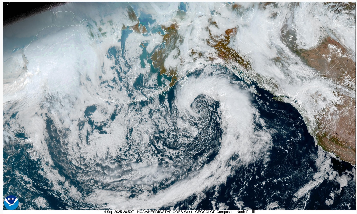
Above: 9/14/25 - NOAA Satellite photo below shows cold rain bearing front in Gulf of Alaska which should travel down the West Coast of Canada and the US if unimpeded by geoengineering methodologies
California can be seen in the lower left with the SF Bay Area and a strange band of clouds coming from the Pacific Ocean - at around 11 - 11 - 1 o'clock of front seeing some flattening of roundness
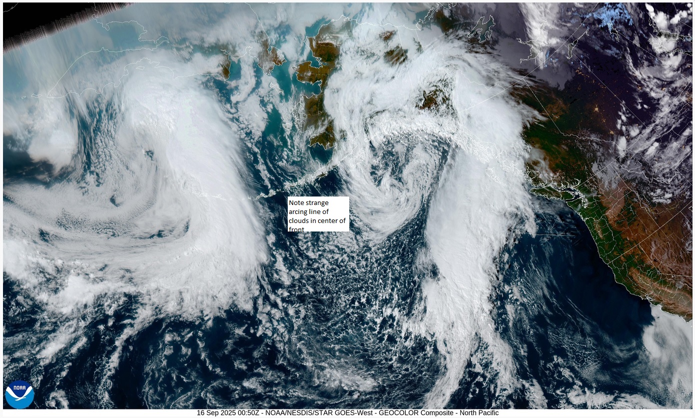
9/16/25 - Front appears to be partially broken up and is no longer a tightly coiled
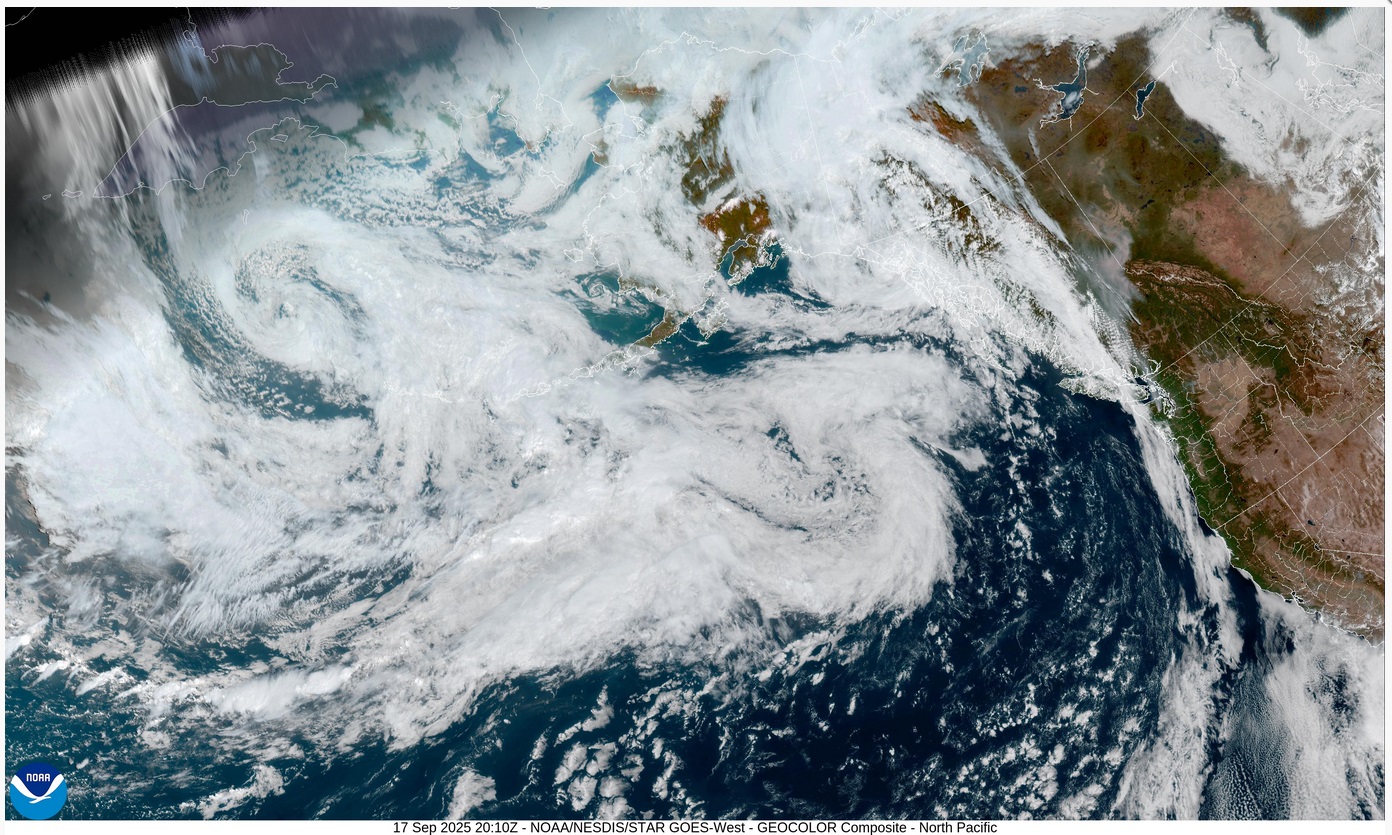
Above: 9/17/25 Front appears as an amorphous mass far from Pacific coast and has apparently lost its energy - just see clouds along WA, OR and small amount of NorCal coastline - note another flattened front in upper left of satellite image - it will likely meet the same fate
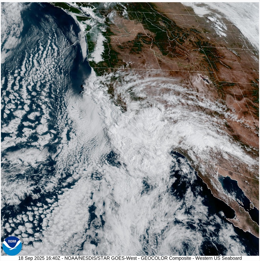
Above9/18/25 Disintegrated front moves ashore over CA and SW US - NOTE: area around SF Bay Area curiously clear along coast - no rain in SF Bay Area, just some high clouds, wind and lower temps